Well as the title says, I had a Very Big Day on Saturday 9 November. After a few postponements due to weather and bushfires, the day finally arrived for me to do my pre-test, solo navigation, and navigation test for my Cross Country endorsement for my Pilot Certificate. So big a day, in fact, that I have decided to split the report into 3 separate entries. Today’s entry will cover the pre-test, which was an assessment flight to Young, NSW wherein anything that needed to be brushed up on or revised could be noted and worked on.
It has been 10 days since all this and only now am I able to fully process everything, hence the delay. There’s no delicate way to put it – I was absolutely buggered!
I arrived at 0630 with coffee in hand to start gathering my wind and weather reports and forecasts and calculating my headings, speeds and times for my flight plan. It was a little cloudy, and there was the possibility of isolated showers in the Sydney area, but otherwise things looked fine. Since it was going to be a long day with multiple legs to the journey, I only worked up the calculations for the first leg out – the rest I would plan to do later while resting between flights, as the wind speeds and directions could no doubt change drastically over that time and render my calculations useless.
In retrospect, I am glad there were a few weeks of delay. The J170 had still been in for its 1,000 hourly maintenance, meaning I’d have had to use the older J160. I am sure that would have been fine as well, but I’ve been with the J170 for so long that I just felt more confident with it. Also, it did give me more opportunities to practice flying the route at home on Flight Sim X, which really helped in terms of reinforcing the fluidity in the cockpit workflow.
So I did the preflight as normal, the fuel was full already so no need to call for the fuel truck. This is the earliest I have had to start before, and it turned out to be a comical moment because the Bankstown controllers and ground ops guys were chatting on the radio about their weekends and such. Once I could get a word in, I made my taxi and departure requests and we were off!

So the plan for the day was to fly to Young which I would do via Camden to the West, then South to Moss Vale, West to Goulburn and onward to Young. That is the preassessment as well as just knocking off the rust after a 2 month break. Then at Young, I’d prepare a solo flight plan which would see me over the bustling metropolises of West Wyalong, Forbes, Parkes, Cowra then back to Young (with a stop over in Forbes to rest in between). Upon my presumed successful return, I’d then prepare the flight plan and maps for the trip back to Bankstown – the Cross Country test!
So we got rolling and in the air around 0730 to nice calm winds and made my first waypoint within one minute of my estimate. This is the little pond/reservoir we call “tadpole” because of its shape (and because no one wants to say they are flying to “sperm-lake”).
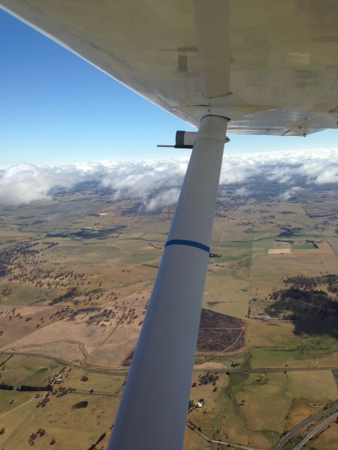
Gentle turn to the South for Camden making the appropriate radio calls and maintaining the CLEAROFF work cycle. After passing Camden on my way to Moss Vale, I found myself a couple miles off course – looks like the winds were stronger than I had accounted for, and had a bigger effect over the longer leg than it did on the short leg to Camden. So I was able to use the 1-in-60 technique to get back on course toward Moss Vale and just before the right turn to Goulburn it became apparent that the thickening cloud base was going to settle at my chosen altitude of 4500 feet! This became a practical and very real application of many principles of flying, first and foremost maintaining visibility with respect to the Visual Flight Rules – and this time, it was not hypothetical and I did not have the luxury of time for a lengthy thought process or discussion over it.
We actually used this to get the Low Level flying done, which we needed to do anyway, staying well below the cloud but sufficiently above the ground. Per the Visual Flight Rules, if we are under 3000 feet, then we only need to remain clear of cloud and within sight of land or water features. Above that, there are specific distances to remain both above or below a cloud, as well as horizontally. It did make for a much bumpier ride, but we did get to the next waypoint, Goulburn, on time and Brett threw a diversion at me. Instead of flying straight to Young, he wanted me to go North to Crookwell, then resume flight toward Young.
I quickly drew a new track on the map and eyeballed some headings, figuring i’d have time on the way to refine. However, as soon as we turned North to the new heading, the cloud base appeared to be getting lower and lower. Brett left the decision to me as to how or whether to proceed – as we had just passed Goulburn, I chose to turn back and wait it out there. He seemed very pleased with this decision – I could have chosen to try to go over or under the clouds, or just back to Bankstown, but this was the safest option in my opinion.
I landed on the grass cross-strip favoured by the wind direction and taxied over to the hard surface near the sideways-blowing windsock. We wandered over to the nearby flying school and had a cup of tea while we waited it out. After an hour or so of watching the clouds and the windsock, the blue sky magically reappeared and before long we were back on our way.
In the interests of time, rather than continue the planned diversion to Crookwell, we decided to proceed straight for Young as Brett was fairly satisfied with my ability to plan a diversion and make decisions in the air. I called Melbourne Centre on the radio (a first for me) and advised them of the change in the flight plan so they could update my notification details and set a new search and rescue time (SARTIME) for arrival into Young. On the way, I measured the time it took me to cross a couple of landmarks and calculated a new ground speed. The wind was really picking up, because by this time, I was only doing around 50 knots – slower than some of the cars beneath me on the Hume Highway! Between Goulburn and Young you can follow the Hume Highway for a little while, then it bends away and there isn’t alot else to see.
So of course it wasn’t long before I was a little bit “temporarily uncertain of position”.
Using dead reckoning, I could get a rough idea of a probable area I should be in, based on heading and time since my last positive fix. Then based on this probable area, I should be able to see features on the ground which I could then correlate back to the map. So it turned out to be a good thing that I had done a ground speed check earlier; since I was going so much slower than the plan, I knew also that I would not be as far along on the map as I might otherwise have thought. Just ahead I saw a peak that stood out as being the tallest feature and was able to relate it to my probable position on the map. Once overhead, I resumed my track to Young.
Before long I spotted what was most likely Young. Based on time-map-ground, it really couldn’t have been anything else – but I still had to find the aerodrome. As I was tracking toward the town, I decided to maintain that and found the aerodrome by using the information on the ERSA page. According to the diagram, the town is 3.1 miles at 145 degrees from the field – so all I had to do was take the reciprocal of that which would make the aerodrome 3.1 miles from the town at 325 degrees.
Within a minute or so, I spotted Young aerodrome and joined the downwind leg of the circuit for runway 19. Other traffic also announced their intentions to do the same, but they were a ways off yet. After landing, I backtracked and parked near the “terminal”, which is really just a little one-room shed with a table.

Took a quick bio-break and walked around to stretch my legs, then got the wind and weather info and ate while working on my flight plan for the solo. A chicken schnitzel sandwich from the day before sounded like a much better idea than it turned out to be – it was dry and horrible.
Brett is originally from Young, so his mum came out to visit. She is a very nice lady, and obviously very proud of her son the pilot! The other traffic we heard on the radio eventually landed and taxied over for a nature break as well. They turned out to be a nice older couple who were up from Canberra in their Cirrus. After a little small talk they were on their way and I was back preparing my plan and getting started on another preflight inspection. I must have been pretty nervous, because while walking around I walked right into the still propellor blade which caught me right in the ribs and left a couple of nice bruises. After assessing that the propellor and my ribs were OK, I finished up and shook Brett’s hand and taxied for runway 19 to resume my journey and my first ever solo cross country flight…
…To Be Continued…


