PPL – Done and Dusted!

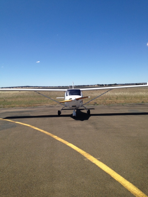
I really have been horrible about updating this… but I promise I have not been idle!  Last Monday, 1st of September 2104 to be exact, I finally took and passed my flight test for my Private Pilot’s Licence!  More on this in a little bit.

Since my last update, after earning my Controlled Airspace Endorsement, I did what is called a Pre-licence Flight Test.  This was a long cross-country trip where I had to go through all of the paces from startup to shutdown and everything in between.  It was much like the test I did for the Recreational certificate, and much like that one, I found that at close to 3 hours of flying my brain was fried and I had trouble with some of the basic things.

In a nutshell, we went north via the Lane of Entry to Parramatta > Patonga > Warnervale and Cessnock where we did some touch and goes and engine failures.  I got a little discombobulated on the circuits and it took me awhile to get into the groove of it.. I also am finding that after a leg of straight and level, my brain takes some waking up to get back into the procedures of circuits.  So that was one area that needed improvements.

We departed Cessnock and on the way to the defunct Aero Pelican strip (YPEC) on the outskirts of Lake Macquarie we did our steep turns, stalls, incipient spins.  I found YPEC with no problems, and of course Chris pulled an engine failure on me right there…  no problem, from 3500 feet I had all day to get to the strip.  We just did a go-around and I began the trip back via Warnervale.

Before I could get back up to height, Chris threw in a line of hypothetical angry low clouds between us and I had to get down to 1500′ and get us to Mangrove Creek reservoir.  Luckily, I could see Warnervale from where I was, so I estimated my position, drew a line to the new waypoint, eyeballed the degrees for the track, subtracted 12 degrees for magnetic variation, a bit more for the crosswind, and determined a new heading.  Once I got us pointed in that direction, I worked out ground speed and an estimate for time.  Now it was just a matter of waiting the time, and looking for clues along the way.  I ended up very close, within a mile or less, and within a minute or 2 of my estimate.  Not bad for low level and being unfamiliar with the landmark.

We pointed back south so I could look for the Brooklyn Bridge and hop on the Southbound Lane of Entry back to Bankstown.  On the way we did another .2 hours of instruments – turns, descents, climbs, standard stuff.  We made it back to Bankstown and this is where I mentioned earlier the circuits started to really fall apart.  I did them OK I guess, nothing to write home about for sure, but neither Chris nor I were happy with them, especially knowing that I have done much better in the past.  

We then spent a few hours going over all of the knowledge items I should brush up on for the oral test before the flight test – Chris is a real trooper, they do not pay him near enough I am sure!

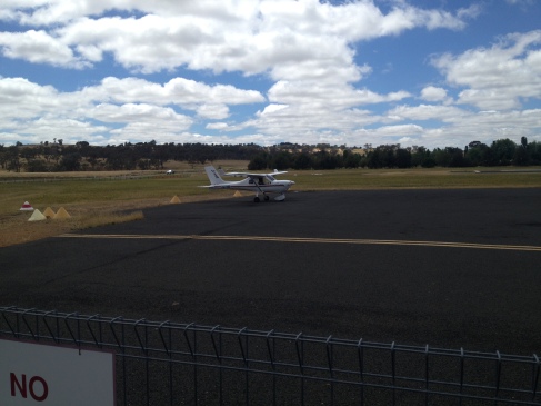
So I made a booking to do more circuits and a bit more practice in the training area, just to make sure I had stalls and steep turns down.  That was a very busy weekday, and workload was even higher – even had a runway direction change in the middle of joining on the arrival procedure – I had read about that but never had to do it!  Talk about pressure!   But, I just did what the tower told me and was now doing circuits on runway 11L instead of 29R.  After a couple of those, the tower moved me over to runway 11R (having me cross all the way over on a long crosswind leg).  For the final landing, I did request 11L so I’d be closer to the taxiway back to Schofield’s.  That was done as a short field landing, and we came to a stop before the first taxiway intersection.

We were much happier with the procedures and I had been working on the knowledge items, so we were happy to start thinking about booking me with a Testing Officer to do my official flight test!!

Of course, it immediately started raining for the next several weeks which is never helpful when you want to strike while the iron is hot.  After a couple of weeks, Bill rang me and scheduled Monday the 1st of September at 9 am as it looked like it was going to be the only decent day for weeks on either side (which more or less turned out to be the case).

This actually gave me quite a bit of time to study all of the items I missed on my PPL written exam, which would need to be discussed during the oral exam, as well as all of the other items of general aviation knowledge I needed to brush up on.  He wanted me to plan 3 different scenarios, and depending on the weather we would pick the best one on the day.  I even bought new charts so I wouldn’t risk adding confusion with my already well-loved charts.  I always donate my old charts to the flying school, they are good for new students who will need to learn how to read them but won’t need to buy them for awhile yet.  Pay it forward…

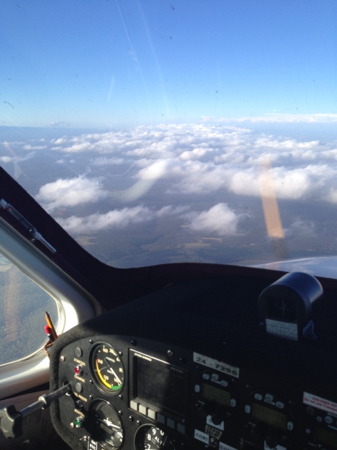
When the day arrived, of course I was out there bright and early (before they opened of course) and got myself settled with some coffee and looked over all of the area forecasts.  I decided I would have the best chance by choosing option 3, which was up to Cessnock again then to Singleton, Denman, then Mount McQuoid, Calga, and back.  Winds and cloud cover was very light in this direction, and I had recently done most of it during my pre-test, so it should be familiar enough.  Why make it hard on myself, right?

Did the weight and balance and performance charts, finished out my flight plan, submitted my notification, called for full fuel then grabbed my wad of papers and went in to get Bill.  Without going on too much about it, I feel like I did very well on the oral exam portion, definitely felt well-prepared (thanks, Chris!).  

I went out and did a preflight-inspection on trusty old INH and before long, I was starting up the engine with Bill in the right seat with his testing officer hat (and glare) on, and the dreaded Clipboard.  Now Bill has been doing this for longer than I have been alive, and he just oozes authority.  Think back to when you were 17 and taking your driving test – and now imagine your grandpa (who is also the sheriff and a former race car driver) is the one giving the test, and I think you’ll get the idea.

Anyway, the flight itself was much like the pre-licence flight so no need to bore with those details.   Mistakes were certainly made, and nerves were at an all time high.  But in the end, it appears that they are mostly interested in whether you recognise and correct your mistakes, and whether you are safe.  I am not sure I would have passed myself, but I must have done OK because he passed me!

We did a very long debrief session afterwards where we went over everything I did wrong, what I did right, what I could have done differently.  He had me listen to some recordings and checked my comprehension so that he could tick the box for “speaks English” (whatever…).  Then he extended his hand and said “Congratulations”.

So now I am just waiting for the paperwork, reflecting back on a long and circuitous path to this point, pondering what is next, and scheming my first trip!  I now have almost 85 hours in the logbook, and it took only about 16 hours in the Piper with the Recreational Certificate behind me – I would suggest however one’s mileage would vary widely – some might do it quicker, and some might take significantly longer.  In the end, I feel like I had a very solid grounding in piloting and navigation, thanks to Brett over at Sydney Jabiru, and that my skills were sharpened and my confidence increased thanks to Chris at Schofields.  I have been very lucky to have been put with some very bright and talented instructors, and only hope I can emulate their examples.  

I am just beginning to be broadly aware that I don’t even know what I don’t know, and will be learning aviation for the rest of my life!  For now, I just plan to enjoy the privileges and sharpen my skills through experience.  Who knows where this will take me – the sky is the limit; and it turns out the sky is a very big place!
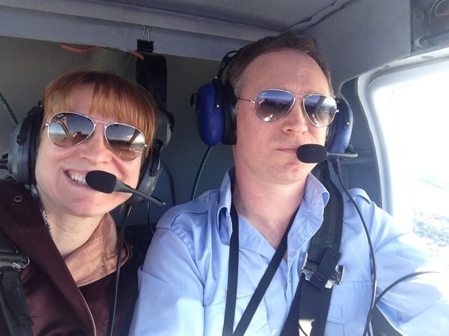
Quick Update and Catching Up

I have been a very busy flier these last few weeks – haven’t even had time to really update here since my first lesson in the Piper Warrior en route to my PPL Licence!

I am going to try to be concise here and sum up the last couple of lessons, as things are moving quite quickly now.

Following the long lesson in the training area and circuits, I have done 2 short cross-country trips to make sure that my navigation procedures are sound, and also to brush up on everything else in preparation for the licence test.

The first trip was from Bankstown to Cessnock via the VFR Lane of Entry to the north. The plan was to fly via Parramatta, Hornsby, and Patonga to Warnervale then on to Maitland and Cessnock before returning via the southbound VFR Lane of Entry.

I think following the success of the last lesson, I was actually a little bit nervous this time – you always feel that maybe last time was a fluke or too good to be true. Inspection, taxi, and departure were great however on leaving the area I had some trouble identifying Parramatta and went towards Chatswood to the east until I got my bearings. I forgot to change to the Sydney radio frequency and change my transponder from 3000 to 1200. All stuff I know and do all the time, but just forgot due to nerves. No biggie, all worked out and corrected. Made great time to Patonga and headed up to Warnervale and learned a new trick.

My planned heading and speed were so accurate, that at the expected time I did not see Warnervale though I thought I should have.  Chris showed me a good trick – do an orbit!  That seems like a no-brainer in hindsight, but it was just the right thing to do.  I did a left hand orbit and soon realised that I was smack on top of Warnervale within less than a minute of my planned arrival – just hadn’t seen it over the nose or under the low-wing of the Piper.  Anyway, finished out the orbit and made my way to Maitland where we did a touch-and-go with about 17 knots direct crosswind.

That was a slightly tough landing, and on take off my seat scooted back a bit and I asked Chris to take the controls.  This is a dangerous situation, and I made sure that it got reported after the flight (and the plane was indeed put into maintenance after).

Another thing I’ve had to get used to is relying on the directional gyro for heading.  The Jabiru didn’t have one so I got used to using the compass or the heading indicator on the glass panel. So I had to get my head around that.

On this trip also I seemed to be letting my control over altitude get sloppy – must work on that!

After flying overhead Cessnock, I turned back around and headed back to Warnervale.  Of course it wouldn’t be that simple – Chris wanted me to divert to Norah Head on the coast near Lake Tuggerah.  My diversion techniques still seem to be sound, and got us there within 2 minutes of my estimate.  Over the lake we did some more steep turns and stalls, and he introduced me to the topic of recovering from incipient spins.

Those are a great deal of fun and not as daunting as it may seem – just ailerons neutral and power to idle, full opposite rudder (really put the boot in!) and then level out and add power when recovered.  These aircraft are not designed to spin, nor would it ever happen in normal flight, but it gives an idea of how to recover if it happens – for example on a too-tight turn onto final.

So the return was pretty normal and other than really keeping my altitude accurate, I felt it was successful – more so than I’d have expected given only my second time in the Piper.  It really is a lovely intuitive aircraft to fly!

A week later, i booked my second cross-country tip – this time to the south, and we were going to add a few new tools to my toolbox.

The plan was to go west to Warragamba Dam then south to Goulburn, then on to Crookwell, Bindook and back again via the dam.  This went very smoothly and happy to say that I was on top of my transponder and frequency changes – but I’ve done this trip more often ;-).

I hit local landmark Tadpole Lake and Warragamba Dam each within a minute or two of my plan, then on the long 40 minute stretch to Goulburn, Chris instructed me on how to use the navigational aide called the Non Directional Beacon, or NDB.  This really feels like cheating to me, but adds another layer of accuracy to navigation.  In a nutshell, an aerodrome will have a beacon that transmits on a particular frequency.  You tune to this frequency, listen to the morse-code identifier, and test the system – then you have another dial to look at called the Automatic Direction Finder, or ADF.  The needle simply points in the direction of the beacon – simple as that!

I am also pleased to say I held my altitude and heading extremely accurately on this trip, so I guess I got that bit worked out of my system!

Anyway, did a touch and go at Goulburn then headed towards Crookwell.  There we did a simulated engine failure and worked on precautionary search and landings – PSLs.  Over all not bad, just have to remember to make my PAN-PAN call and a few other small things.

Now it got fun!  On the way back, it was time to start my introduction to instruments!  We got up to 7500 feet and headed right into some clouds (Chris is an IFR instructor, so its cool).  He explained how the attitude indicator is the primary thing I should look at, and to keep the dot in the centre and wings level at all times.  Then of course, I can move the dot up or down and turn as necessary, but to maintain focus on that.  Other instruments can then be used to verify my speed, rate of climb/descent, etc.

I was absolutely gobsmacked at how easy it was to be utterly convinced you are in one position only to find out you are really in another.  What I “felt like” was a gentle climb into the clouds, turned out to be a nose-down descent which I saw once the cloud cleared!  You have to learn to not trust your senses AT ALL.  The eye just picks out the nearest straight line and says “ok that’s the horizon” and your brain just works everything around that.  You could actually be flying completely inverted and as long as you got there gradually, you might not even know!

So that was sobering, but exhilarating all the same.  We did this for about half an hour, mostly with a hood on so I could not see outside.  I think that was plenty for the first time, but can’t wait to do it again.  Of course NEVER on my own!!

I used the ADF to reach Bindook, then instead of continuing to Warragamba, Chris threw a diversion in – let’s go to The Oaks airfield….   Ok fine I say and draw my line on the map, adopt the new heading, then start making adjustments for wind.  I have a little trick for the Oaks – if you can see Camden, the runway is pretty well aligned with the Oaks.  So I just flew on my new heading, found Camden and followed the runway more to the West then got over The Oaks within 2 minutes of my revised ETA 🙂

After this it was just a matter of going back to Prospect Reservoir and then Bankstown.  I did forget to set my transponder back to 3000 on entering the Bankstown control zone.  I need a way to remind myself…. after a 3.1 hour trip, my brain is just fried!

So we had a good briefing, got a nice list of things I did right and things I need to work on, and am now busy preparing for my next flight – for my Controlled Airspace Endorsement!  I got some great constructive feedback and he said he thinks probably I might have even passed had that been the real test!  Wow… I wouldn’t have thought so, but he knows best!  We’ll see – the pre-test flight is next weekend 🙂

More soon….

Thank You For Flying Air Mellow

Yesterday I was able to put another core aviation goal behind me – I finally got to take my sister up for her first flight in a light plane! She’s always been a bit more reserved when it comes to risk-taking, so this was a huge step for her. I am lucky I was able to get her to agree to go up with me…

Last year we gave her a Red Balloon gift card, that’s the outfit that you can buy all kinds of adventure experiences through – she could have gone hang gliding, or hot air ballooning, or a day at the track in a V8… or even a spa day or that kinda thing… so I was really impressed when she rang up the folks in Camden and booked a joy flight in their Chipmunk warbird. She had a great time, but the aerobatics was all a bit much for her and she ended up sick and a little terrified of the whole thing. So I had my work cut out for me.

Anyway, I pulled a fast one and for her birthday this year I promised her an hour scenic flight with me as PIC. How could she refuse?? I just had to make sure I picked the right day and that I was extra on top of things, because I knew there’d probably only be this one chance to get it right and make it good for her.

We scheduled it for the Saturday the 7th, and after a week of really crappy wet weather, imagine my joy when I woke up at 545 am and the weather was just gorgeous and looked like it was going to be great all day! She came by and we drove down to YWOL, with the traditional greasy Macca’s stop on the way to get my blood sugar appropriately satisfied.

Anyway, flying-wise it was pretty much the same as every other trip up and down the coast near YWOL – for me – but it is always special to me to experience it for the first time through someone else’s eyes. Takeoff was perfect, tiny bit lumpy as we came up to the level of the escarpments, but I warned her about that, and all the turns were nice and slow and gentle, a little bit bumpy here n there, but over all very nice and just couldn’t have asked for a better, more picturesque day. I was told by a mate in the marine rescue that the whales are out in force now, but we didn’t see any.

She did a good job with her task as “flight photographer” and “plane spotter” – kept her busy and engaged. She spotted the Stearman before I did even! 🙂

Landing was nice and smooth though a bit off centreline. Taxied back to parking, and by this time she is just so full of joy and pride, and I think she felt like she conquered her fears. She said now she will not hesitate to go back up, and her cage is “unrattled” haha. Another item off my bucket list!!

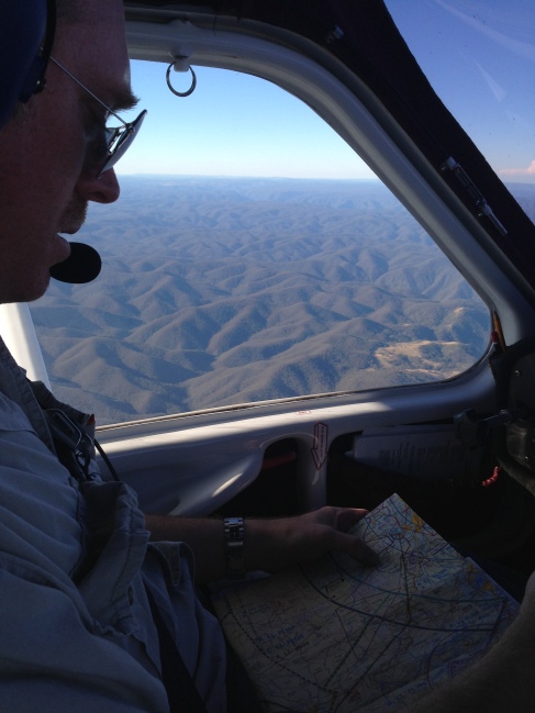
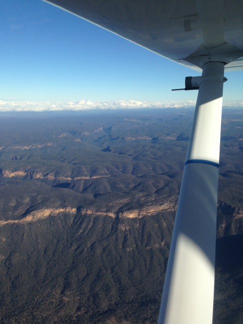
Coupla piccies of the day…

Image

windy day…

Image

cruisin…

Image

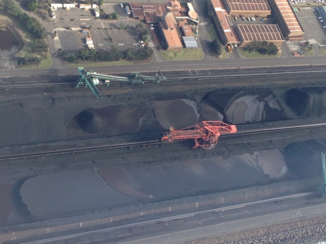
even the industrial filth has a certain beauty from the air…

What A Big Day Looks Like

Just thought I’d put in some numbers to boil down the last few articles into an easy-to-consume summary.

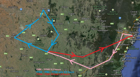
Approximately 1000 km flown, or about 540 nautical miles, or 621 miles.

8.1 hours of flying time, 3 being solo.

Average speed about 123 km/h, or 67 knots, or 77 mph.

121 litres of AVGAS, or about 32 US Gallons

Max altitude:  7500 ft

Min altitude: 500 ft

And a quick sketch of the route:

Image

My Big Day – Cross Country Pre-test, Solo, and Flight Test – 3/3

This is the final installment of my long-overdue update on the Cross Country endorsement.  After what turned out to be a 3 hour solo flight due to stronger than forecast winds, I returned to Young with another small personal triumph under my belt.

Which was nice, because the last Triumph I had, I had to sell to pay my mortgage after a layoff.

Anyway, just like on a motorcycle, after (now) 6 hours in the saddle, I had a serious case of Monkey-butt and was in no hurry to get started right away.  It was the middle of the afternoon so I only needed to make sure we left in plenty of time to get back to Bankstown well before the end of daylight.

So I walked around to stretch my legs, drank plenty of water, and settled in for the final stage of planning for the return trip.  While I was doing that, Brett topped up the fuel in the Jabiru just to make sure.

Plan was (nominally) just to go back the way I’d come – via Goulburn to Moss Vale then up to Camden and over to Bankstown.  I say nominally, because this was the Test and anything could happen and it certainly did.

As this was the test, I made extra sure to leave no stone unturned when it came to planning.  I have to demonstrate to Brett I’ve done all the flight planning including wind speed and direction, heading, ground speed, and estimated times.  I had to show proper fuel planning, weight and balance calculations, as well as my planned route.

Once he was satisfied, we strapped ourselves in an taxied once again to runway 19 and made a standard takeoff and a crosswind departure to the East for Goulburn.

But before we even got to the chosen height of 7500 feet, Brett goes into Role Playing mode and says he’d like to check out his property near Crookwell.  So… a diversion for the first Task.

Image

No problem.  So I keep trimmed for straight and level flight and draw a new line on my chart and quickly estimated that it was about X degrees off my original heading.  So I changed to that heading and kept it straight while I worked out an estimate for the effects of the forecast winds so I could refine the heading and ground speed and calculate my estimated times from that.  As luck would have it, once I was on the new heading I could see a huge windfarm dead ahead which seemed to correspond to what I expected to see on the map – so all I had to do was keep focused and maintain that heading.

Once overhead the windfarms, I couldn’t see Crookwell so I needed to use dead reckoning to look for some other features and see if I could refine my position.  As it turned out, the wind farm I saw was a bit to the South of the ones that I thought they were – so I had myself temporarily convinced I was headed in the right direction.

But dead reckoning is like that, and given it was an unplanned diversion, it still got me in the right area – Crookwell was just a couple of miles to the North – so a quick left turn and I was overhead in a few minutes and had my positive fix.

That was rather easy, so this time Brett decided to turn up the heat a little – he now wanted to fly over the Wombeyan Caves.  This is a popular tourist attraction but if there is anything caves are reliably known for, its not being visible from the air.  So while I did get us in the area, Brett had to point them out to me.  It wasn’t exactly like Disney World, but at least we got there and he’s happy with my ability to divert and get un-lost.

Image

The biggest lesson I am still learning is having proper expectations of what I’ll see.  For example, just because the chart shows a river, it might be a dried-up little track in the dirt.  What looks like a township on the chart might be a few houses and a silo.  And so on…  So its about not waiting to see what you think you’ll see, but flying accurately and having a good idea of the range of what is possible.  That will just be a matter of experience, I’m afraid.

So at this point, Brett just said “take us home”.  I could see the massive gorge that parallels the dividing range between us and Sydney, and was able to spot enough features to know exactly where I was.

Image

I just cruised it on in toward Camden, but had the same issue coming back as we did leaving, a cloud layer between me and where I needed to be.  So I did a spiral descent in a clear area to get down to 2500 feet or so and continued on to Bankstown where I managed exactly the sort of landing you’d expect after a full day of flying – no points for style.

Image

The debrief was short and sweet, just a few minor corrections and observations but overall he was happy with everything and I am happy to say has signed off on my Cross Country endorsement!  This removes the 25 mile radius limitation from my departure airport, and opens up the entire country to me!

My next step is my Passenger endorsement – I only lack 2 solo hours and a quick checkride.  Actually, at the time of this writing, that’s been done as well – stay tuned!

My Big Day – Cross Country Pre-test, Solo, and Flight Test – 2/3

Hello everyone – I realise it has been over a month since attaining my Cross Country endorsement, and almost as long since my last post – its been a busy month, and unfortunately I’d been suffering from a bit of CBA Syndrome (couldn’t be arsed).

But its been on my to-do list for so long, that in fact it has migrated over several of them, as other things get ticked off and I realise its time for a new list… the blog always seems to be the “carry over”.  So I am hoping to rectify that so I can get on to more recent news and announcements.

When Last We Met, I was taxiing by myself for Runway 19 at Young aerodrome.  In many ways this trip was to be the culmination of everything I have learned as a pilot.  Every single lesson would be called upon – from takeoff and landing, straight & level, and turns as well as the more advanced subject of navigation, including planning, arrival and departure procedures, situational awareness, and communication – and possibly low-level or lost and diversion procedures!

But to keep it simple, it still boils down to the three main priorities – Aviate, Navigate, Communicate.

The plan was to leave Young and fly over West Wyalong and land at Forbes for a break before continuing up to Parkes then back via Cowra.  All up, a little over 200 nautical miles which would take about 2.5 hours at the current wind speeds and planned cruise speed of 90 knots.

Now, I’d be lying if I said I wasn’t both giddy with anticipation and shitting down both legs in terror that I was finally about to undertake this flight that was over 2 years in the making.  Despite the common public perception of pilots, I’m no dare-devil, fearless, swashbuckling aviator who laughs in the face of danger.  In fact I am pretty much a coward.  But what I am good at is assessing and managing risk in real-time and I have faith that I have been trained well enough to call upon that training should crisis assert the need.

So having left Brett standing there, and having taxied and lined up on 19, and before I had any time to think about it, I gave it full throttle and tracked the centreline until I was airborne.  This was my first solo flight since earlier this year and I’d almost forgotten how much quicker everything happens without the extra weight of the instructor.  And with the engine just out of maintenance, it climbed like the proverbial homesick angel!

Another nice thing about solo flight, besides the relative silence, is there is an extra seat for all the stuff – I no longer have to balance it all on my lap.  Seems a bit easier to gather the thoughts when I’m not also maintaining a parallel track of thought dedicated to vocalising everything I am doing for the benefit of the instructor.

So up and up I went – 300 feet, flaps up.  1000 feet, turn to the West and set first heading for West Wyalong.  I had planned originally a cruising altitude of 4500 feet to avoid having to consider the VFR hemispherical cruising altitude rules, which state if you are above 5000 feet and traveling in a direction between 0 and 179 degrees magnetic, then your altitude must be an odd number of 1000s + 500 (5500, 7500, 9500, etc) and from 180 to 359 degrees, it must be even 1000s + 500 (6500, 8500, etc).  Just one less thing to think about.

However it was rather bumpy at this level and if I wanted to get above it, I would have to get to 6500 feet in keeping with my westerly heading.

Unfortunately there was a pretty thick cloud base at about 5000 feet so I could not penetrate the layer (legally) and was destined to just tumble along at 4,500 below the clouds (observing separation minima) – shaking and rolling with every updraft until finally the clouds thinned out and I spotted an opening!

Image

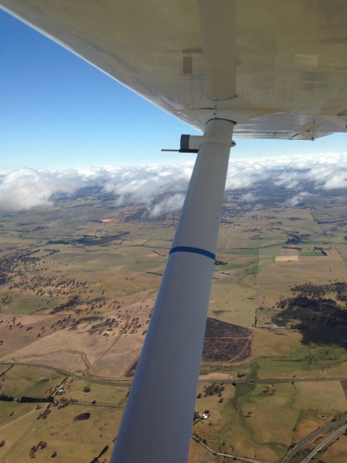
Steering around to get myself between clouds and maintaining VMC separation, I found a nice wide open area and got myself up to 6500 feet in 4-5 minutes or so.  Ahhhh much nicer, and of course I could see much farther as well.

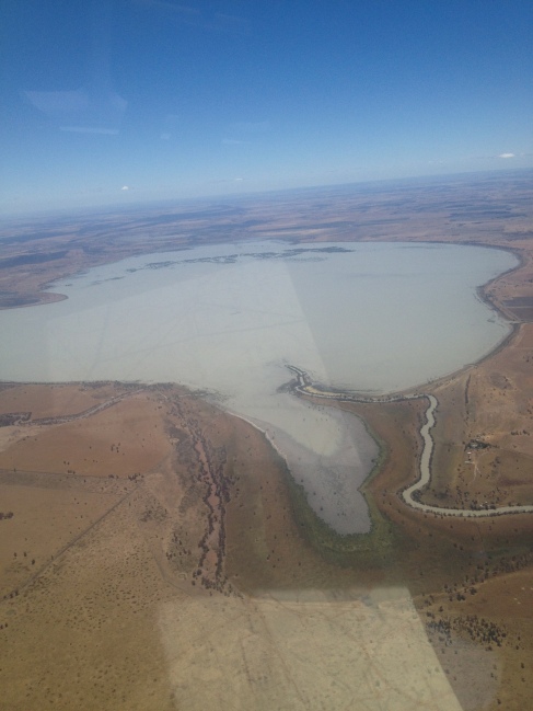
Before long I was overhead West Wylong and making my right turn to Forbes where I planned to stop and stretch my legs and take it all in.  To the left is a wonderful visual landmark – Lake Cowal – which is big enough to see from West Wyalong and track along side almost until I could see Forbes.

Image

Image

As the wind was more or less westerly (though quite gusty) I joined left downwind for runway 27 at Forbes and did a functional but probably less-than-graceful flapless approach and landing, and taxied to park close to the aero club.

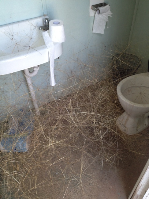
I knew Forbes was a rural strip, but I had no idea that it was going to be utterly deserted – that was a strange experience, never having been the only one at an aerodrome.  Not even anyone in the club house, nearby hangars – no one.  There were tumbleweeds blowing around as if to underscore the situation.  The club house was locked.  The men’s toilet had even managed to become some vortex of tumbleweed congregation.  I guess the overwhelming feeling was “its all on you now”.

Image

So I walked around some more (and of course called my Mum to let her know I was down safe).  There was a cool crop duster plane that I had a look at.  But time was getting on and I still had to get back to Young so I could start planning for the flight back to Bankstown, and the wind was really picking up and turning into a bit of a crosswind.

Image

I taxied and backtracked 27, managed a nice crosswind takeoff, and departed the crosswind leg for Parkes to the North.  I had hoped I’d be able to see the famous radio telescope but apparently its quite a bit further out of town and there just wasn’t time.

Since my direction changed to northeast, I settled at 5500 feet though it was still bumpy.  The sky was nice and clear and the land marks I’d highlighted on the map were easy enough to follow until I was overhead Parkes.  I am not sure, but I think when I made my overhead radio call, I may have said “Forbes traffic…” rather than Parkes… it was a big day and I am still surprised I held it together as well as I did.

So I made a conscious effort to relax a bit and breathe deeply to make sure the stress of constant focus wasn’t going to cause any real lapses of attention.

After that it was pretty much a matter of following roads and a river to Cowra then a final right turn back to Young.  Before long, I was on descent from 5000 feet and lined up for a straight-in approach.

Young being the Cherry Capital of NSW, I knew Brett would be waiting there with a fresh locally baked cherry pie for me and several kilos of cherries for his mates back in Sydney.  More importantly, I knew he’d be Watching – so naturally I stuffed up the first approach and did a go-around so I could set up for a better landing.

Image

I got it down and taxied back to the “terminal” for another break to rest and prepare for the next and final stage – the Cross Country Flight test!

… To Be Continued…

My Big Day – Cross Country Pre-test, Solo, and Flight Test – 1/3

Well as the title says, I had a Very Big Day on Saturday 9 November.  After a few postponements due to weather and bushfires, the day finally arrived for me to do my pre-test, solo navigation, and navigation test for my Cross Country endorsement for my Pilot Certificate.  So big a day, in fact, that I have decided to split the report into 3 separate entries.  Today’s entry will cover the pre-test, which was an assessment flight to Young, NSW wherein anything that needed to be brushed up on or revised could be noted and worked on.

It has been 10 days since all this and only now am I able to fully process everything, hence the delay.  There’s no delicate way to put it – I was absolutely buggered!

I arrived at 0630 with coffee in hand to start gathering my wind and weather reports and forecasts and calculating my headings, speeds and times for my flight plan.  It was a little cloudy, and there was the possibility of isolated showers in the Sydney area, but otherwise things looked fine.  Since it was going to be a long day with multiple legs to the journey, I only worked up the calculations for the first leg out – the rest I would plan to do later while resting between flights, as the wind speeds and directions could no doubt change drastically over that time and render my calculations useless.

In retrospect, I am glad there were a few weeks of delay.  The J170 had still been in for its 1,000 hourly maintenance, meaning I’d have had to use the older J160.  I am sure that would have been fine as well, but I’ve been with the J170 for so long that I just felt more confident with it.  Also, it did give me more opportunities to practice flying the route at home on Flight Sim X, which really helped in terms of reinforcing the fluidity in the cockpit workflow.

So I did the preflight as normal, the fuel was full already so no need to call for the fuel truck.  This is the earliest I have had to start before, and it turned out to be a comical moment because the Bankstown controllers and ground ops guys were chatting on the radio about their weekends and such.  Once I could get a word in, I made my taxi and departure requests and we were off!

Image

So the plan for the day was to fly to Young which I would do via Camden to the West, then South to Moss Vale, West to Goulburn and onward to Young.  That is the preassessment as well as just knocking off the rust after a 2 month break.  Then at Young, I’d prepare a solo flight plan which would see me over the bustling metropolises of West Wyalong, Forbes, Parkes, Cowra then back to Young (with a stop over in Forbes to rest in between).  Upon my presumed successful return, I’d then prepare the flight plan and maps for the trip back to Bankstown – the Cross Country test!

So we got rolling and in the air around 0730 to nice calm winds and made my first waypoint within one minute of my estimate.  This is the little pond/reservoir we call “tadpole” because of its shape (and because no one wants to say they are flying to “sperm-lake”).

Gentle turn to the South for Camden making the appropriate radio calls and maintaining the CLEAROFF work cycle.  After passing Camden on my way to Moss Vale, I found myself  a couple miles off course – looks like the winds were stronger than I had accounted for, and had a bigger effect over the longer leg than it did on the short leg to Camden.  So I was able to use the 1-in-60 technique to get back on course toward Moss Vale and just before the right turn to Goulburn it became apparent that the thickening cloud base was going to settle at my chosen altitude of 4500 feet!  This became a practical and very real application of many principles of flying, first and foremost maintaining visibility with respect to the Visual Flight Rules – and this time, it was not hypothetical and I did not have the luxury of time for a lengthy thought process or discussion over it.

We actually used this to get the Low Level flying done, which we needed to do anyway, staying well below the cloud but sufficiently above the ground.  Per the Visual Flight Rules, if we are under 3000 feet, then we only need to remain clear of cloud and within sight of land or water features.  Above that, there are specific distances to remain both above or below a cloud, as well as horizontally.  It did make for a much bumpier ride, but we did get to the next waypoint, Goulburn, on time and Brett threw a diversion at me.  Instead of flying straight to Young, he wanted me to go North to Crookwell, then resume flight toward Young.

I quickly drew a new track on the map and eyeballed some headings, figuring i’d have time on the way to refine.  However, as soon as we turned North to the new heading, the cloud base appeared to be getting lower and lower.  Brett left the decision to me as to how or whether to proceed – as we had just passed Goulburn, I chose to turn back and wait it out there.  He seemed very pleased with this decision – I could have chosen to try to go over or under the clouds, or just back to Bankstown, but this was the safest option in my opinion.

I landed on the grass cross-strip favoured by the wind direction and taxied over to the hard surface near the sideways-blowing windsock.  We wandered over to the nearby flying school and had a cup of tea while we waited it out.  After an hour or so of watching the clouds and the windsock, the blue sky magically reappeared and before long we were back on our way.

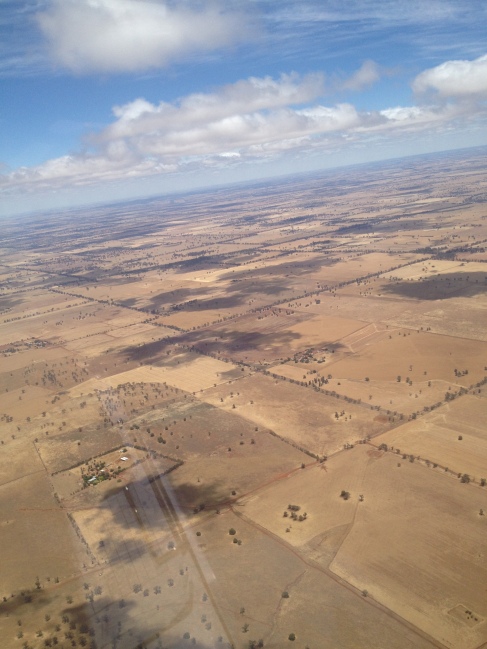
In the interests of time, rather than continue the planned diversion to Crookwell, we decided to proceed straight for Young as Brett was fairly satisfied with my ability to plan a diversion and make decisions in the air.  I called Melbourne Centre on the radio (a first for me) and advised them of the change in the flight plan so they could update my notification details and set a new search and rescue time (SARTIME) for arrival into Young.  On the way, I measured the time it took me to cross a couple of landmarks and calculated a new ground speed.  The wind was really picking up, because by this time, I was only doing around 50 knots – slower than some of the cars beneath me on the Hume Highway!  Between Goulburn and Young you can follow the Hume Highway for a little while, then it bends away and there isn’t alot else to see.

Image

So of course it wasn’t long before I was a little bit “temporarily uncertain of position”.

Using dead reckoning, I could get  a rough idea of a probable area I should be in, based on heading and time since my last positive fix.  Then based on this probable area, I should be able to see features on the ground which I could then correlate back to the map.  So it turned out to be a good thing that I had done a ground speed check earlier; since I was going so much slower than the plan, I knew also that I would not be as far along on the map as I might otherwise have thought.  Just ahead I saw a peak that stood out as being the tallest feature and was able to relate it to my probable position on the map.  Once overhead, I resumed my track to Young.

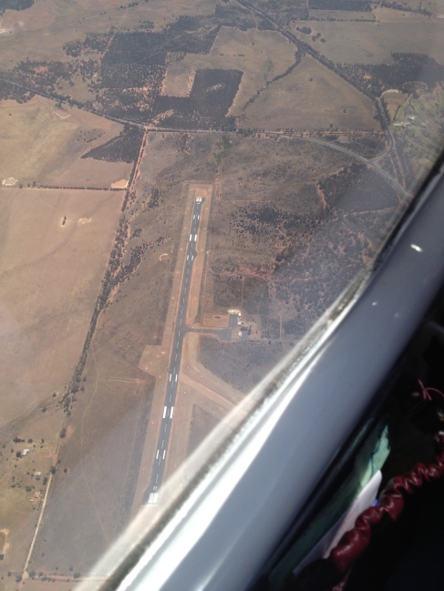
Before long I spotted what was most likely Young.  Based on time-map-ground, it really couldn’t have been anything else – but I still had to find the aerodrome.  As I was tracking toward the town, I decided to maintain that and found the aerodrome by using the information on the ERSA page.  According to the diagram, the town is 3.1 miles at 145 degrees from the field – so all I had to do was take the reciprocal of that which would make the aerodrome 3.1 miles from the town at 325 degrees.

Within a minute or so, I spotted Young aerodrome and joined the downwind leg of the circuit for runway 19.  Other traffic also announced their intentions to do the same, but they were a ways off yet.  After landing, I backtracked and parked near the “terminal”, which is really just a little one-room shed with a table.

Image

Image

Took a quick bio-break and walked around to stretch my legs, then got the wind and weather info and ate while working on my flight plan for the solo.  A chicken schnitzel sandwich from the day before sounded like a much better idea than it turned out to be – it was dry and horrible.

Brett is originally from Young, so his mum came out to visit.  She is a very nice lady, and obviously very proud of her son the pilot!  The other traffic we heard on the radio eventually landed and taxied over for a nature break as well.  They turned out to be a nice older couple who were up from Canberra in their Cirrus.  After a little small talk they were on their way and I was back preparing my plan and getting started on another preflight inspection.  I must have been pretty nervous, because while walking around I walked right into the still propellor blade which caught me right in the ribs and left a couple of nice bruises.  After assessing that the propellor and my ribs were OK, I finished up and shook Brett’s hand and taxied for runway 19 to resume my journey and my first ever solo cross country flight…

…To Be Continued…

Third Navigation Exercise – Low Level Navigation and Diversions.

Well, my luck has continued with unbelievably clear calm weather – always a welcome circumstance when I have a lesson planned, doubly so when I am learning new concepts.   This weekend, I finished up the remaining items in the Cross Country endorsement syllabus – Low Level Navigation and Diversions.

I arrived on Sunday at 11:00 for a 12:00 flight to get the weather and finish my flight plan and chart preparation.  Brett arrived around 12:00 with the previous student, but since I am the last student of the day there was no particular hurry.  He called for fuel and nuked his lunch while I worked out all of my headings, ground speeds, time and fuel calculations and generally got myself organised.

I performed the usual preflight inspection, my ritual of calm where I start getting in the zone.  I did note that it is close to due for its 100-hourly inspection, but we should be OK for that.  Overall the little J160 is about the same as last time I flew it, but I will be glad when the J170 is back online.  Although covers and plugs are in place, 24-7047 lives outside and it shows.  It just looks and feels tired to me.  I don’t blame it.

In addition to covering new material for the syllabus, I had another new procedure to learn, as we were departing to the north to Cessnock;  the Lane of Entry is a track into and out of Bankstown for VFR aircraft to follow.  On the map it looks like a line of purple dots, and it helps maintain an orderly flow of traffic as well as separation from commercial and IFR flights (i.e., the Big Boys).

So in a way, it was easier since the lines and headings and landmarks are already on the map, but it is a higher mental workload at first as you do need to stick to it strictly.  So, a whole new set of thoughts to process in addition to the usual.

It was a sunny, gorgeous, almost windless day – and Brett warned that the scenery could be a distraction; its tempting to just sit back and enjoy the sights!  But  no… we were here to work, and work we did…

After the preflight and getting taxi clearance, and completing the run-up checks, we lined up on runway 29R and departed to the west.  At 500′, I turn right to the north and before long I have my first waypoint, Parramatta, in sight.

Suddenly the EFI (electronic flight instruments) panel starts flashing a red alert – High Voltage alert!  This is similar to the alternator warning on your car and means that it is providing a constant charge, implying too much load on the system.  Brett had me circle back to Prospect Reservoir as it looked like we may need to turn back.

But he had me fly the plane while he looked through the manual to do some troubleshooting.  He turned off some unnecessary lights and equipment and the voltage went back into the normal range.   We decide to resume, but this will definitely have to be looked at at the next maintenance (and certainly before I fly it again!).

Overhead Parramatta, I changed heading slightly towards Hornsby and was overhead in just a few minutes.  Basically following the Westfield shopping centres!  After Hornsby the urban sprawl diminished and I set my heading to Patonga and from there turned North to Warnervale.  It was at this point I could see what Brett was saying about the scenery – we flew alongside Ettalong, Brisbane Water, Tuggerah Lake near Wyong before reaching overhead Warnervale right on schedule.

As we passed Warnervale and set a heading towards Cessnock, Brett informs me there is a lowering cloud mass ahead and we’ll need to fly under it!  Could have fooled me, as there wasn’t a cloud in the sky, but I go with it.

A quick review of the Visual Flight Rules (VFR) minimum separation was in order:  If you are below 3000′, you must stay clear of clouds and within sight of land or water.  Otherwise, maintain 1000′ above or 500′ below and 1 km horizontal distance from any clouds.  The minimum heights are 500′ above the ground – or 1000′ over built up areas or large gatherings.

Right.

So we did a quick scan ahead for landmarks and a look at the map shows there are some hills and towers up to around 700′.  So for safety, we fly at around 1200′ (500′ over the highest point) from Warnervale to Cessnock.  But first the plane needs to be set up and an alternate navigation method to the CLEAROFF work cycle checks I described in my last post.

The new mnemonic for low-level navigation is FREHA – Flaps and power for slow flight, Radio, Engine checks, Height, and Aimpoint.  So now instead of the usual cycle of Time > Map > Ground and CLEAROFF checks, this is more like driving a car – eyes outside of the cockpit most the time, only looking inside to verify constant speed and height.  It is actually a lot of fun though occasionally bumpy being lower to the ground.  That’s really it in a nutshell – basically fly around and steering from point to point visually.

Here is a photo Brett took as we were making our way through the valley between hills:

Treetop Flyer anyone?

We landed at Cessnock after joining the circuit for runway 35.   Parked and walked over to the Recreational Aviation club hangar to have a chat and a look around.  They have a couple of nice Tecnams I wouldn’t mind trying out some day and a very nice simulator set up.  I have been encouraging Brett to look into setting one up in the school; I think it would be a great addition and provide another avenue for practice on rainy days, something to do while waiting, or an inexpensive means to demonstrate a concept or provide remedial training without the wear and tear on the plane (or wallet).

After a quick pit stop to use the facilities and refilling my water bottle, I taxied back to runway 35 for a downwind departure to the south for the return to Bankstown.

My original (nominal) plan was to go back to Warnervale then follow the Lane of Entry to Bankstown via Brooklyn Bridge to Prospect Reservoir – but of course that would have been way too easy – especially since I can see the Sydney skyline from there!  But this leg of the flight was for the purpose of learning how to divert – for example to another aerodrome in case of fuel or weather problems, or to get around an obstacle such as clouds or smoke.  In fact, I had a preview of this last time when I had to divert around the smoke over the Blue Mountains, so I was mentally prepared for it.

Brett picked a random landmark on the map – Mangrove Creek Reservoir to the west, and had me work out how to get there from Warnervale.  In flight, you don’t have the luxury of time to measure everything out perfectly, and he has taught me several techniques to use mental maths to determine heading, ground speed, and times.

So while still enroute to Warnervale, I drew a line on the chart from Warnervale to the reservoir, estimated that the angle looked “about 30 degrees” from the direction from which I just travelled, then made some adjustments for magnetic variation and wind to determine what should be my new heading, ground speed, and estimated time.  Once overhead Warnervale, I turned to that heading, noted the time, then flew in that direction for about as long as I estimated.

This was a little difficult as I was having problems spotting reliable landmarks to verify my position, but Brett helped me there and advised me just to maintain my speed and heading unless I had a good reason to change it.

Sure enough, it looked like the speed and time estimates were almost perfect, and the heading estimate was off by a few degrees, as I arrived only 2 miles south of the reservoir right at the time I expected.  This is pretty good for just eyeballing the heading on the chart – if I’d used the protractor and E6B, I have no doubt I’d have arrived overhead, but at height 2 miles is just fine as I now had a positive fix.

The track from there to Brooklyn Bridge (to pick back up on my original plan) was easy to estimate, as I noticed that the line was parallel to my original track from Cessnock to Warnervale – in which case heading and ground speed would be the same; so that saved me a bit of time in calculations.

I arrived over Brooklyn Bridge and now had to learn a new procedure:  I had to call Sydney Radar to let them know I was 2300′ over Brooklyn Bridge, southbound.  This is to let them know that I am joining the inbound VFR lane of entry.  The acknowledged me and actually I was a little far left so they did ask if I could move to the right a bit more.  That is one of the requirements for using the lane of entry, stay to the right.  For future reference, if I make sure I keep the Sydney-Newcastle Freeway to my left, I should be OK.

Before too long, I could see Prospect Reservoir, so I started a nice cruisy descent to 1500′, got the Bankstown terminal info, and made my call over Prospect inbound to Bankstown.  I was told to use runway 11L – so in my absence, the wind had changed enough that they changed runways – and to report again at 3 miles out.  It just so happens that the railroad tracks are 3 miles out, so I made my call over the tracks and was cleared to land on 11L – a nice straight-in approach.

Taxied over to parking, put the covers on, and headed back into the hangar for the debrief. Got some great feedback, and a few minor comments including some advice on how to fold the map better, and we had a chat about some new procedures – for example, in the case of a real diversion, I would also need to make a radio call to amend my flight plan.  Also, we talked a bit about what to do if the charging problem had gone the other way – low voltage instead of high.  In this case, the alternator would not be supplying a charge and the battery would eventually die – leaving me without lights, radio, avionics, electric fuel pump, or flaps!  Again:  Aviate – Navigate – Communicate comes into play and first priority is just keep flying.  Loss of battery will not stop the engine, so the plane can still be flown.  in the ERSA, the procedures are spelled out for how to approach and land if communications are out.  I could even call the tower on my mobile and talk to them that way (though with Vodafone service, I’d pretty much have to be perched on the cellular antenna to be sure I’d have signal…)!  But the main thing is, as always – fly the plane.

If you’ve made it this far, I’ll relate a couple of interesting sights along the way.  On the way south from Cessnock we saw a 747 overhead, roughly perpendicular to my path, though several thousand feet higher.  There was plenty of separation, but I could see it was blue – Thai Airways I think.

A little bit closer and of more immediate concern, I spotted a large bird of prey hovering just above my path, just soaring along the thermals, and I passed right under him.  Judging by his size and shape, I think it might have been a wedge-tail eagle, but I can’t be sure since I didn’t get a good look at the tail (I just wanted to make sure not to get any closer).  It was quite the majestic sight, and I wondered what he thought about this big ungainly creature streaking along beneath him.

So that’s it.  I’ve completed all of the requirements of the syllabus for my Cross Country endorsement.  What remains is to do a solo navigation and pass a flight test!  The solo exercise he has planned for me looks like a tour of country NSW:  Starting in Young and navigating to Cootamundra, Temore, Wyalong, Forbes (where I’ll land and stretch my legs) and then back via Parkes and Cowra.  I hope there are some good visual references out there – the map looks pretty sparse!

Between now and then, I’ll be studying and looking for ways to streamline reference materials for in-flight use.  Any of you out there going through this or have done it, I’d love to hear your experiences as well!  If I have any interesting facts or anecdotes to share that are aviation-related, I’ll be sure and update!

Second Navigation Exercise (Lost! What’s Your Plan??)

… But I’m near the end and I just ain’t got the time
And I’m wasted and I can’t find my way home….‘ – Blind Faith, 1969

Its been over a month since my last lesson, but thankfully the weather was perfect – yet another in a long string of sunny, cloudless, mild days as we wrap up winter here in Sydney.  A bit surprising, given my usual luck is to have it rain precisely on the day of my lesson after any number of perfect days.

Originally the plan was to fly over Katoomba over Bathurst and Orange to Mudgee where we’d stop and plan our way back.  However, the school was down an aircraft with the J170 being in for maintenance so Brett asked me if we could have a later start and cut the lesson shorter by only going to Bathurst.  That worked out for me, as we would be able to cover the same things without having to go so far anyway.

As is my wont, I rocked up about an hour early to get the weather report and finish up my flight plan.  Weather was good, but winds were reported as “variable”, which makes it a little harder to accurately plan a heading and ground speed.  To be conservative, I just kept the headings the same as track, and allowed for half of the wind to be headwind – we could figure it out once we were up there in it.

So I filed a plan with Air Services Australia to go from Bankstown to Prospect Reservoir, Katoomba, Oberon, Bathurst and return via Bathurst to Oberon to Camden to Bankstown.  In moments, Air Services called up and requested a change – Prospect is a busy inbound reporting point, so would be better off not using that as a departure waypoint if I could help it.  Fine, so I revised the plan to go via Warragamba Dam out to the West, then up to Katoomba from there.

To add another new experience, the school recently acquired another Jabiru plane – this time a J160 model.  The main difference is it has a somewhat shorter wingspan, so I could expect a slightly lower glide ratio and less tendency to float.  Performance and handling I was told should be roughly the same as the J170 I am used to.  Some of the instruments and equipment are in different locations or in some cases are different brands, so I had to factor in a quick learning curve.  Didn’t present too much of a problem once I figured out a few new buttons and knobs to do the familiar tasks.

Preflight inspection, taxi and takeoff were all pretty much normal.

As is usual here at this time of year, there are many control burns going on – this is where the Rural Fire Service deliberately burns back strategic areas of bush so as to reduce the possibility of wide-spread bushfires.  On a warm and windless day like today, this means there was an area of dense smoke covering most of the Blue Mountains – visibility was practically zero in that area, and in fact it was a bit hazy everywhere.

The air vents in the J160 seem to be aimed a bit differently because my papers and charts were blowing around, which was a bit distracting as well.  I don’t know how the guys in the open cockpits do it!

So with that, it looks like I was off track to my first waypoint, a local small pond called “Tadpole” because it is shaped like one.  With Brett’s help, we sighted it and I changed our heading to fly over it, then adopted a heading to the next point which was Warragamba dam.

I had not actually used Warragamba before, so I wasn’t too familiar with the view from above.  By the time we spotted it, I was actually about 3 miles South of it.   So now I am starting to get a picture of what the winds are doing, but from 4,500′ looking Northwest, I could see that the whole area around Katoomba was completely obscured, so there was no point in even attempting to resume my plan to go there.

Had I been solo, I would probably have just turned around and gone back, but Brett was with me to show me what to do and add some more tools to my collection.

We weren’t planning to cover diversions today, but we had no choice in this case so it was a good unplanned practical lesson.  From our position South of Warragamba Dam, we picked a prominent spot nearby – Trial Hill about 5 miles SW of Warragamba, and used that as a new waypoint.  When we reached it, we did a nice spiral climb to about 6,500′ so that we could see over all the smoke, then changed to a heading which worked out to be almost parallel to our original planned track.  This worked out well as it took us almost straight to Oberon, thus bypassing Katoomba altogether.  That was a shame, because I was really hoping to be able to take some nice pictures of the area.

So at this point in the exercise I have developed a very strong impression at how mind-bogglingly easy it is to be utterly convinced of where you think you are located and where you think you are heading!

So now with composure regained and new headings, we arrived overhead Oberon and ultimately Bathurst only 5 minutes later than our original plan.  The key to this is being vigilant with the cockpit work cycle – known as CLEAROFF’s – a methodical cycle of things to check:  Compass, Log, Engine, Altitude, Radio, Orientation, Fuel, Forced landing – part of this is noting each positive fix on the chart and a time.

If you’re vigilant with this, then navigating is very simply a matter of Time > Map > Ground.  That is, you can look at the time and know where you should be based on heading and speed, look at the map to see what you should be seeing, then look at the ground to confirm.

On arrival to Bathurst, we flew overhead at 1,500’ and determined that the wind was actually favouring the dirt cross-strip, so we joined the circuit for runway 26 and I was able to perform my first landing on a dirt strip!  It was very smooth and I had no issues, though i could probably have been a little closer to centre…

Backtracked on 35 to parking and spent some time in the Bathurst Aero club,  where a nice gentleman allowed us to use the facilities and use the space to have a stretch and talk about the plan back. This time, the plan was to forget the plan as we were going to get lost!

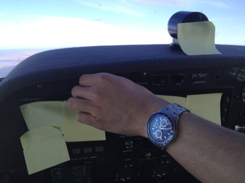
By then the wind had changed direction so we backtracked and used 17 for a South departure.  Since we were heading East, I climbed to 5500’…. then Brett took away my maps and covered all of my instruments with Post-it notes:

Image

He had me change to a random heading of 150 degrees and we just flew for 10-15 minutes.

After that time, he gave me back my maps and instruments and said “OK get us unlost”. So knowing where my last positive fix was, and my heading, as well as a quick calculation of ground speed I was able to find a probable area which I circled on the map – then things started popping into view – powerlines here, a river there, and before long a postive fix over Teralga.

Finding the probable position based on knowing the position of your last positive fix, direction, speed, and time is called “Dead Reckoning”.  When you have logically determined a rough area based on where you “should be” based on the above, the cycle temporarily changes to Time > Ground > Map…. look for features in the area of probability, then try to correlate to the map.   When you think you have a fix on the features, start looking for other features to support it – rivers, roads, power lines, lakes… anything.  With 3 supporting features,  you can call it a positive fix!

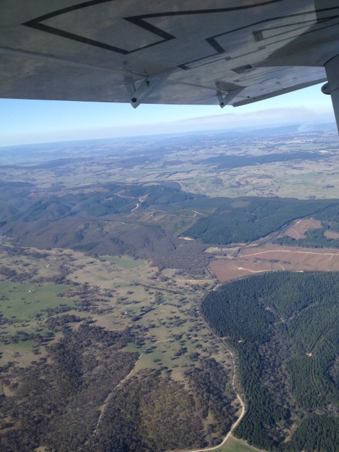
Somewhere between Oberon and Teralga:

Image

I found that power lines work really well, so I saw a prominent set and paralleled them until it started crossing rivers and roads and other features I could match up to the map.  Before long a substation came into view!

I marked that as a possible fix on the map.  Thinking I had it, I turned east to follow the power lines coming from the substation.  I started spotting towns, but their position showed me that I was wrong about the substation – at least it wasn’t the one I thought it was, but it did get me in the right area.  Dead Reckoning is not meant to be 100% accurate, and really I could have been anywhere.  But it was close enough, and in a few minutes I spotted a couple of towns along with 2 distinctly-shaped reservoir and a major junction of railroad tracks.  I was passing between Moss Vale and Bowral!

Now I had a positive fix, and we were un-lost.  I followed the railroad tracks to Picton then Camden where I was able to resume my original plan which was to have been Bathurst to Oberon to Camden to Bankstown.

Brett always asks “what is your plan?” to get me to think about my options.  The point is to be flexible and not get overwhelmed in trying to make the flight fit the plan.  If conditions change, always remember the order of priorities:

1. Aviate

2. Navigate

3. Communicate

Basically, above all – fly the plane!  its not going to drop out of the sky if you forget to make a radio call or temporarily lose track of position.   If you always keep this in mind, you won’t get overwhelmed trying to think of a million things you need to do or say if flying becomes a handful.

In a case where I am over unfamiliar rugged terrain, I would have plenty of options – including simply flying East until I see the ocean, then working it out from proximity to Sydney skyline.  Or I could call ATC for help.

Anyway, it was a normal leg from Camden to Bankstown, don’t really even need a map for that anymore.

This was a great lesson and an excellent confidence builder.  Brett was pleased with my ability to get us un-lost.  There will be plenty more opportunities to get lost and found, but it was a good feeling knowing I was able to do it!

So, I am about halfway to having my Cross Country endorsement – next lesson will cover diversions in depth and low-level navigation (500′).  For this lesson I am thinking a trip to Cessnock.  After that, I only need the 2 hours of solo navigation and the test – Brett says we will probably fly out to Young and go through all the paces on the way out – then solo from Young to maybe Cootamundra, Temora, Wyalong, Cowra and perhaps Parkes and back.  Then for the test – “get us back to Bankstown!”.

I am pleased this phase is going so much quicker… once my navs and passenger endorsements are finished, more possibilities open up, including conversion to PPL and maybe even CPL down the track.  Or at the very least start ticking some of my goals off the list.  Stay tuned!

First Navigation Exercise

This weekend, I took my first navigation lesson.  I had actually taken the 4 hours of briefings back in January in anticipation that I’d be doing those at the time.  The plan was to do those flights and work the required solo time into them so that I could end up with my Cross Country and Passenger endorsements at the same time as achieving the certificate.  But after about 4 rained out attempts, I switched gears and went somewhere else to do my solos (thanks Bruce!) and recently wrapped up my certificate (thanks Brett!).

Now that the weather is starting to get good, it was high time to put all that knowledge into practical use.  Up to this point, flying has been all about doing laps around the aerodrome, or practicing maneuvers in the nearby training area.  So now, I am learning and practicing what it takes to get from one aerodrome to another using only a map, watch and compass.  Sure, GPS is available and can be used as a secondary source of information, but it is so important to know how to navigate by reference to the map and ground features – what happens if the battery dies or the GPS satellites go out??

The first exercise was to get from Bankstown to Wollongong and back.  This first exercise is to put into practice the concepts learned in the breifing.

I would estimate 90% of this is in preparation.  Well before the flight, you need to ensure a current copy of all necessary charts.  Plot a course from point A to point B – but this won’t necessarily be in a straight line!  You have to make sure you are clear of controlled airspace or restricted areas as well as making sure you select an altitude that will be well clear of any obstacles or terrain, but that is not too high for the airspace you are in (as depicted on the chart).  For this exercise, we chose to fly at 4,500 ft.

Continuing the preparation, you have to measure the direction of each track in degrees as well as the distance for each segment.  You pick a speed for the aeroplane to fly, we selected 90 knots.

Now True North (as depicted on the chart) is different from Magnetic North (as read by the compass).  There is a variation that is different depending on where in the world you are – its -11 degrees for me here. so without getting into too much technical detail, all directions in the plan have to be converted to degrees magnetic so you can read directly from the compass in the aeroplane without having to think about it.

On the day, you get a weather report – not just any weather report, but the one for your specific area as provided by http://www.airservicesaustralia.com.  This gives aviation-specific weather reporting and forecasts for the area and aerodromes, as well as any important items to be aware of – Notices to Airmen (NOTAMS).  These are important – for example, one NOTAM stated that the automated weather service for Wollongong was not available. So knowing this, I can plan not to try to get it over the radio but instead plan to fly over the airfield at 1500′ to determine the wind direction.

With the weather report, you also get information regarding cloud cover, atmospheric pressure (QNH), turbulence in the area, and winds at various heights.  This is important, because in the flight plan you need to account for the wind direction and strength.  You may need to fly to a point East, but if the wind is blowing strongly from the North, then your heading will actually be somewhat into the wind to compensate for this.  Where the aeroplane is pointing and where it is going are often two different things.  Similarly, the amount of ground you cover in a given time might not be the same as the speed you think you are going. I might be indicating 90 knots of airspeed, but if I am heading into a 10 knot headwind, then my track over the ground is actually 80 knots.  That is important because speed and distance are used to calculate time.

Time is calculated for each segment of the trip.  This is important because you are following a track on your map and you need to have an idea of what landmarks you will expect to see at a given time.  For example, if I’ve calculated it should take me 15 minutes to reach Camden, I should also be able, at 5 minutes, to start seeing landmarks that are roughly a 3rd of the way there.

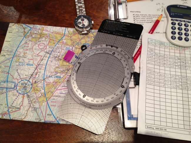
It’s all very complex (to me at least) so I won’t go on about it.  Here is a snapshot of some of the tools used:

Image

Sunday morning was perfect, so I got to the school about an hour early, spread out my gear, got the weather report and finished filling in my flight plan.  The flight plan is the result of all the planning – it is like an itinerary, and tells you exactly which direction to travel, for how long, at what speed, and when to turn.  Sticking to the plan is fairly straight forward – occasionally note the time, figure out where on the map you should be (based on the plan), then look at the ground to verify or adjust.  If you are off or a little fast or slow, you can make a correction to the estimate as the winds are seldom exactly as stated in the report. Brett did ask me when I got the winds, and I said “pretty much right after lunch”.  Not sure if he got it or not.

The plan took us to a point (small lake) 11 miles to the West of Bankstown at 2,500 ft. After that, a turn to the South for Camden and a climb to 4,500 feet.  Any time we approach an aerodrome or airfield, I’d make a radio call just to let them know I am in the area – common courtesy.  Overhead Camden, I turned to the South East to fly over Wedderburn before finally turning more or less South towards Wollongong. since the NOTAM advised that the automated weather service was out, I descended to 1,500 feet and flew overhead to have a look at the windsock before letting down to 1,000 ft to join the circuit for runway 34.  We did two circuits and an overhead departure back the way we came.

I was pleased that my planning was pretty solid because we made it overhead Wollongong within 1 minute of my plan.  On the way back, I think the winds died down a bit so as a consequence I managed a much faster groundspeed than planned for and reached Bankstown about 5 minutes early.  In subsequent lessons, I’ll learn how to refine that ‘on the fly’ so to speak, but I was pretty happy with this first one.

Upcoming lessons will cover diversions (in case the destination can’t be reached due to weather, low fuel, zombie attack), lost procedures, and low-level navigation.  After all that time running uphill to get my certificate, it is amazing to think that I am just a few more lessons away from being able to go cross country!  I am hoping to have that and the passenger endorsement wrapped up by the end of the year, but for now I have a little over a month to absorb what I learned on this trip – what worked out, what didn’t, and what adjustments I need to make.

Next time I will be sure to take some great pics!